Google maps, the truth and how you use it
One of our competitors has come out of the dark with a recent new attack. Now they claim that we have copied them in Google map integration, and what they did was *innovation* but not us. The last time these guys made such an attack on us was to claim that we were too cheap.
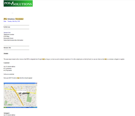
Unlike the early claim of being too cheap, we have no idea what they are talking about Google Maps. I am not sure when we first implemented Google Map integration into our software, but it was before 2009. We were early on to it, as we knew from our discussions with Google on how the system worked. Then it was all new, and no one knew how to make it work. The earliest mention about us having this integration was in our newsletters dated Tuesday 26th May 2009, showing DOS users how to use it. Yes, it was available in our older DOS versions too. As it was a new development that was long stopped in DOS by then, we did it earlier, but I cannot find when.
And before anyone jumps up and down on me, let me say that I looked at some other competitors. They have Google Maps too. Generally, they use a paid service like Pointy. Since we wrote our own API, there is no charge for our users for Google Maps.
Before 2009, it was innovative. It is not innovative in 2022, and pretending that it is, I think, is an absurdity.
So summing up, I am sure that now their users are glad that finally, they have some of the benefits, which our users have had for over 13 years.
Now let us move on and discuss how do we use it?
The easiest way in your software is to look for a box marked "Show Google Map". It is in many places, e.g. see the green arrow in the supplier screen below.
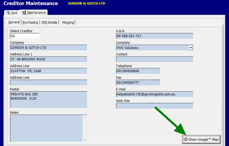
Once you press that box out will pop out in Google Map the location in a map.
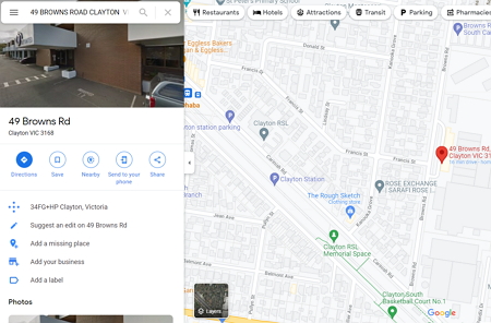
You then have the full facilities of Google Map, although you can do much more than in this simple example.
The following are some of the significant uses our clients are using their Google Maps integration for:
1) If you are going to go to a place you have never been to before. Who knows how far and what the traffic is like going there. Using Google Maps, they can get an estimated time of arrival and an estimated time of return. This makes it much easier to get organised.
2) The primary use that people use is to send the address to their phone, so they can use it for directions while in the car. This saves time.
3) Failed deliveries due to wrong addresses are costly for retailers. It can be a significant cause of customer dissatisfaction. So using this Google Maps integration, you can check that you have the correct address before going out. You need some intelligence here as sometimes Google does not have a valid address. We have had discussions about this. Currently, there is nothing anyone can do about that, but we are actively looking into it.
4) See my post a few days ago on handling many locations and making a route.
I urge you to experiment with these functions and yes there are more, but we will discuss them later when I cool down.
PS Here is an interesting oddity for you, Google Maps was invented in Australia and is an Australian Product. It is True Blue, we do get around us Aussies.

