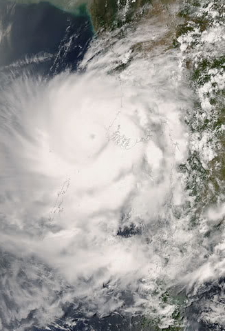
Cyclone Debbie is just a few hours from hitting Northern Queensland, so we rang up all our clients in the general area to make sure that they have a backup, even those a fair way outside the region because in our experience, the power, the Internet and phones often get cut there. Now to do that what we had to do is make a list of those in the area. So what we did was imported our client list into Google Earth and noted all our clients that are in the general area that Cyclone Debbie may go. This is one of the many uses you can use Google Earth.
It can be integrated into our software, and a popular use is delivery runs.
Here are some other uses that I use.
1) If I am going somewhere new, I like to check on Google Earth both the general direction, the approximate location and then where the actual spot, I am going to. So I know the area as well as location. I feel I am much more in control then when I am just using a GPS.
2) Getting a map of where your clients are, export from our software into excel and then import the CSV file into Google Earth and its done. In general its very good for maps.
3) If someone gives me an address, I can check out their shop instantly. For example, whether they are in a shopping centre, a shop, etc. In the city Internet not a problem but in the bush, it might be. Another point is a possible supplier contacted me. I wanted to know are they as big as they claim as it turned out. They were in a little house in the middle of nowhere.
You may have other uses too.
Until a few years ago, Google released its Google Earth Pro version for free, and you'll find it here Just get the Pro version, I do not know why the free version is listed at all.
Then try it out, put in a few street addresses, and once you are acquainted with it; I am sure you will get some use out of it. Just remember that it uses quite a bit of data from the Internet, so you'll need a decent Internet connection in order to use it. I would not go using their flying around on Google Earth on a mobile without WIFI.


